


History of Southeast Asia

Episode 46: The New Guinea Campaign, Part 2
The podcast is back, after a month-long break! Here we continue the coverage we started in the previous episode, about World War II in New Guinea. This time we will see the crucial turning point in the conflict between the Japanese, Australians and Americans.
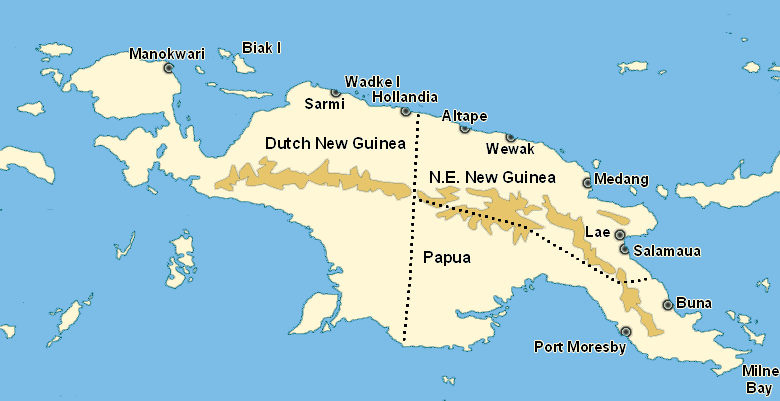
This map of New Guinea gives you an overview of the island during World War II; most of the cities and towns I mention in Episodes 45 and 46 are shown here. Before the war the western half of the island was part of Dutch-ruled Indonesia, while the two territories in the east, N.E. New Guinea and Papua, were ruled by Australia. The mountains running through the middle, the Owen Stanley Range, also roughly mark the front line in the second half of 1942; the Japanese captured most of what was north of the mountains, while the Allies held on to everything south of the mountains, as well as Milne Bay on the island's eastern tip. Source: www.historyofwar.org.
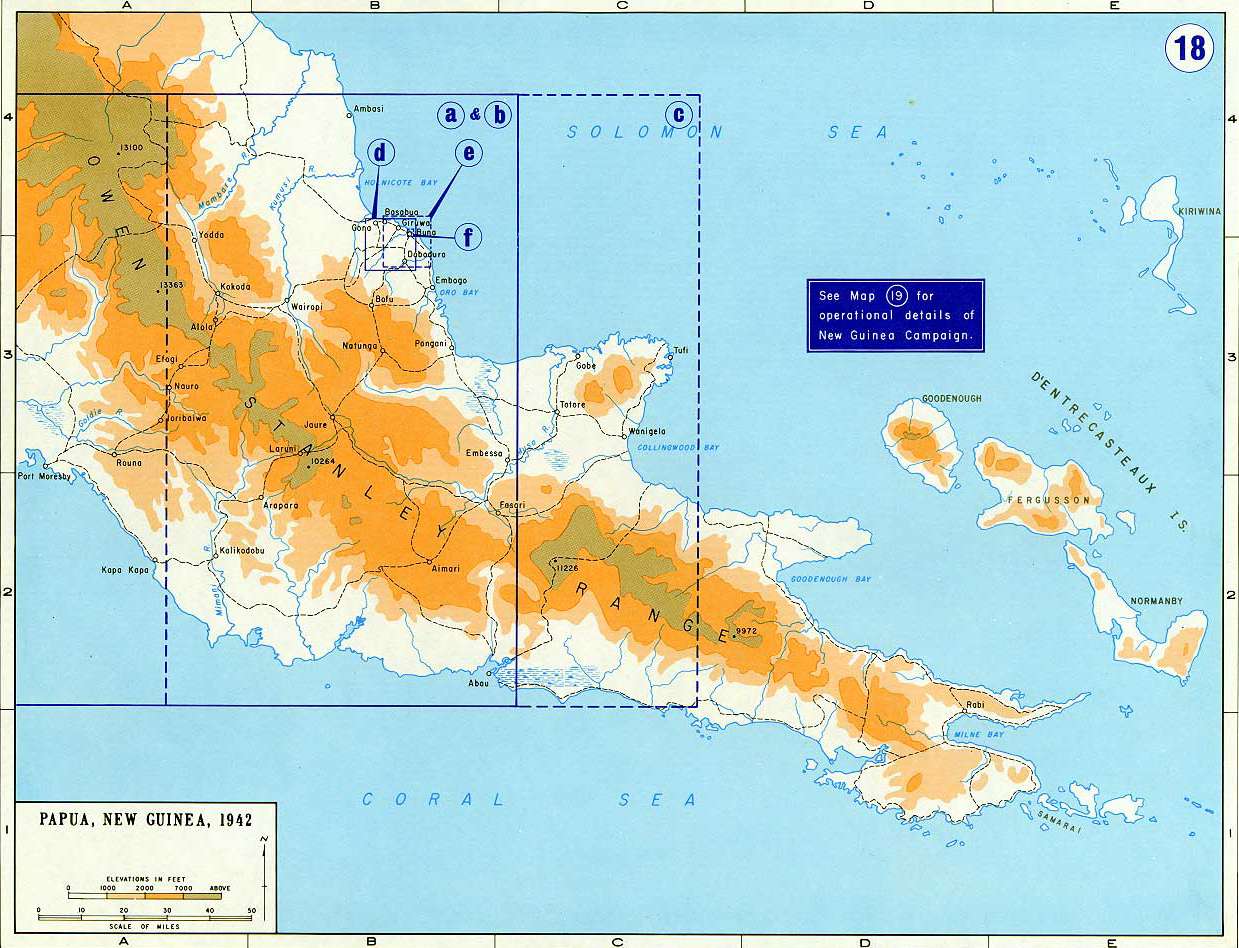
Here is the first of two maps that show in detail the course of the battles covered in the next podcast episode. This map shows southeastern New Guinea, the "tail" of the island. The rectangles enclose the areas shown on the second map. Also visible is Milne Bay on New Guinea's eastern tip.
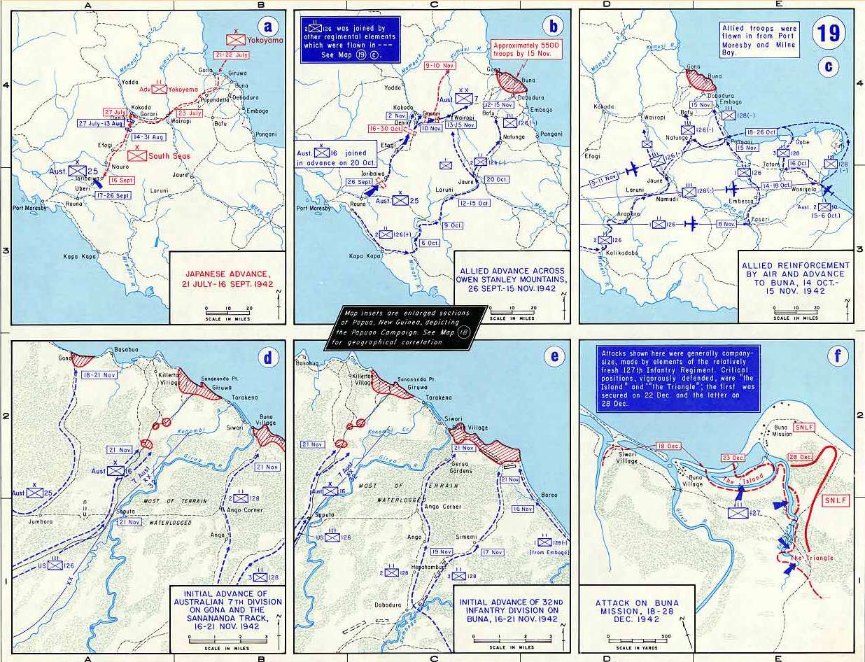
This map (or "maps" if you prefer) shows six closeups of the Kokoda Track and the Buna beachhead. I found this map and the previous one on two websites: www.EmersonKent.com and www.WestPoint.edu. Unfortunately I don't know which of them had the maps first, so I am listing both as my sources here.
Do you think you would like to become a podcaster on Blubrry? Click here for the details on joining. Enter my promo code, HSEASIA, to let them know I sent you, and you will get the first month's hosting for free!
Support this podcast!

 Visit Podcast Website
 RSS Podcast Feed
 Subscribe
 Add to MyCast